
Table of Contents
Introduction
The western Mexican state of Michoacán contains the remarkable geological wonder that is Mount Paricutin. Nature enthusiasts visit the 1943 exploding Mount Paricutin for the experience of observing its stunning volcanic formations. People from all over the world come to see Mount Paricutin since it represents both the Earth’s latest volcanic emergence and holds status as a UNESCO World Heritage site.
What Makes Mount Paricutin Unique?
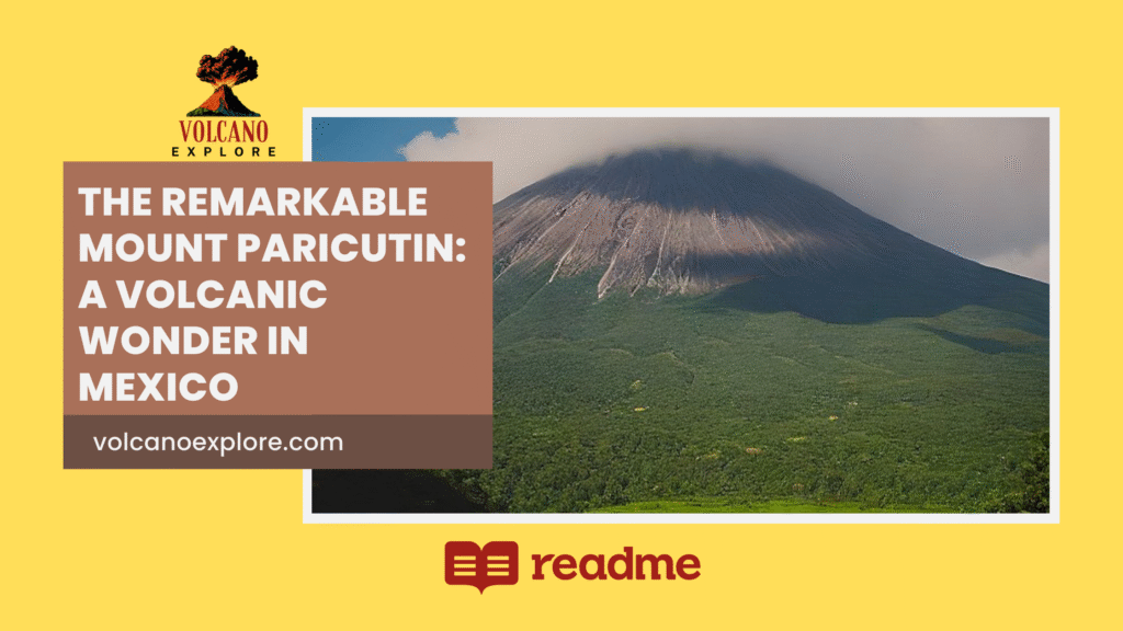
Mount Paricutin obtains its exceptional status from both its recently born origin and the method through which it was created. The explosion of the cinder cone volcano Mount Paricutin emerged from the center of agricultural land, which surprised the residents of rural Parícutin in 1943. The mountain’s eruption lasted for nine consecutive years while reshaping all surrounding regions. Earth features the volcanic site among its most prominent geological formations that exist today.
Birth of a Volcano
Scientists, along with visitors, found the Mount Paricutin eruption to be a phenomenon that sparked intense interest. The Earth showed its first sign as a tiny crustal fracture that eventually took shape into a massive volcanic structure within thirty days. Smoke, together with ash, emerged from the fissure when the eruption started, but over the following month, the volcano expanded in size. Mount Paricutin developed to a height of 1,391 feet (424 meters) during the year 1952. The rapid growth of the volcano exceeded established observations because its expansion rate was unprecedented, while the eruption dramatically altered both the terrain and the lives of village inhabitants.
Today, several villages remain buried by volcanic debris, which includes the San Juan Parangaricutiro town center, where residual damaged buildings reveal the past to modern observers. The scientific interest in Mount Paricutin stems from the fact that observers both documented and researched its formation as people witnessed its birth. Therefore, the volcano is a leading study case for historical volcanic development.
Geological Features
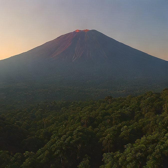
The formation of Mount Paricutin as a cinder cone volcano occurred due to volcanic materials comprising ash along with cinders and lava which accumulated around a vent in the middle. Steep conical features characterize Mount Paricutin because it differs from shield volcanoes that build gentle sloping cones. Dark lava from Mount Paricutin has solidified over time thus creating dramatic visual distinctions against the neighboring scenic areas. Mount Paricutin stands as both a geological landmark and a photographic wonder because its distinct characteristics provide various eye-catching views for photographers.
The volcanic event transformed the area into a fascinating terrain that displayed volcanic rocks combined with ash sediments and solidified lava deposits. The volcanic disaster led to a fertile environment, which allowed plant growth to return to the affected area. The scenic arrangement of destruction with regeneration endows Mount Paricutin with an enigmatic importance that represents natural power in action.
Natural Landscape
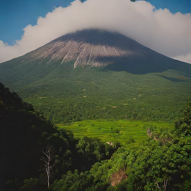
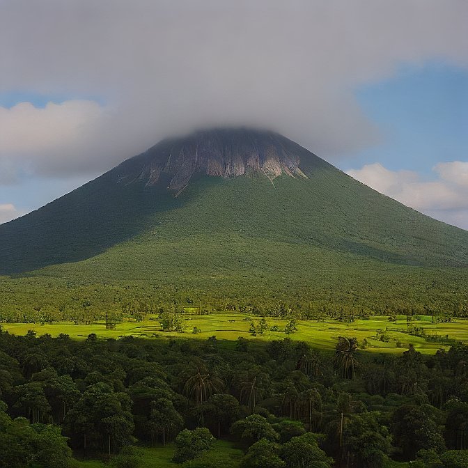
An even more spectacular view than the volcano itself emerges from its surrounding natural environment of Mount Paricutin. Primarily covered by forests, the area maintains extensive farmland together with extraordinary plant and wildlife species. The volcanic land produces abundant fertile soil that supports local farmers in planting crops after the volcanic event. Guests can observe the changing landscape since the past decades to find how agricultural development now coexists harmoniously with volcanic surroundings.
Besides its agricultural bounty, the region protects different varieties of wildlife and fauna. Mount Paricutin’s forests host a mixture of oak and pine trees as well as additional species of vegetation that form suitable living space for animals. From above the volcanic peaks, you can easily spot flying vultures as well as eagles and owls, among other bird species. Surrounding nature along with the powerful volcanic peak provides visitors who seek eco-tourism destinations a remarkable experience through their encounter with both life and death.
Exploring the History
Anthropological connections run parallel to geological history in the story of Mount Paricutin because it deeply shaped the townspeople living near its base. Local people remember the 1943 volcanic eruption with such strong sentiments because this natural disaster entirely transformed their way of life.
The Local Impact
Every single inhabitant in local communities remained astonished as Mount Paricutin erupted unexpectedly. The volcanic event started when farmers from the Parícutin village were working in agricultural fields. Residents were left without warning before the volcanic eruption, so they had to evacuate, and eventually, San Juan Parangaricutiro disappeared as lava and ash layers buried the town. The natural catastrophe solidified its position as a landmark for demonstrating the power of nature because volcanic remnants showcase the church foundation and town structures elevating from the rockified lava.
The destructive event created a new opportunity for scientists from numerous countries to study molecular and geological processes at the growing and active volcano site. Over several years of volcanic activity, the affected villages were rebuilt so modern visitors can now observe the abandoned town of San Juan Parangaricutiro, which showcases its partially submerged church as an emblem of natural power.
Cultural Significance
Local culture associates Mount Paricutin with high importance because of its traditional significance. People remember the eruption because of its disastrous effects, together with the united response that the community demonstrated during the tragedy. The permanent populations recall their survival during the volcano’s eruption through local legends that emphasize why their community thrived despite the disaster.
The area surrounding Mount Paricutin maintains savage cultural importance for the indigenous Purépecha people. The historic territory contains archaeological discoveries that experts link to the vanished ancient community from this area.
Modern-Day Reflection
Mount Paricutin exists today to show the unpredictable ways of nature and commemorates the relentless determination of inhabitants in this region. Tourists are attracted to this site because it provides an opportunity to witness both the geological attributes and historical significance. Nature demonstrates its powerful ability to reshape history when visitors observe the volcano settlement and remnants of destroyed towns.
How to Visit Mount Paricutin?
Striking Mount Paricutin remains a destination that one can only remember because multiple transportation methods exist to visit the spectacular volcanic destination. The main gateway for Mount Paricutin visitors begins at Uruapan since this city lies approximately 50 kilometers away from the volcano.
Getting There
By starting from the bustling cultural city of Uruapan, where they can board a bus or rent a car, tourists can access Mount Paricutin. Local public transportation as well as guided tours provide access for visitors to reach the volcano once they reach the destination area. Small villages, together with scenic scenery, allow spectators to witness the traditional Mexican way of life until they arrive at the base of the towering volcano.
Travelers who explore the base of Mount Paricutin become immersed in an adventure because they will encounter outstanding perspectives of regional landscapes which feature farmlands and intermittent visibility of the volcano’s immense form. Managed tourist guides provide detailed explanations about geological and historical aspects of the region in addition to safe walking experiences for their guests.
Hiking and Exploring Mount Paricutin
Hiking offers the best opportunity to discover the attractions of Mount Paricutin. Residents and visitors can select from multiple hiking paths surrounding the base and running up the volcano slopes to see remarkable views of neighboring terrains.
Hiking Routes
The main hiking trail brings visitors to the top of the volcano, where they can admire scenic views of the surrounding land and see what remains of the lost town of San Juan Parangaricutiro. The trail demands moderate physical abilities because it requires several hours to finish. Therefore, it welcomes visitors in good health.
Multiple trails of different lengths cater to hikers who want mild exercise while letting them appreciate the pathfinding volcano and surrounding landforms. Hikers can experience the terrain’s volcanic layers through this relaxed journey to the volcano base. From the base, they can observe volcanic rock and lava together with ash deposits.
Safety Tips
Visitors should take the necessary precautions when hiking around Mount Paricutin because the experience will stay memorable. Before hiking here, one should always wear secure shoes and bring ample water supplies while ensuring they check for any active volcanic warnings. Sheer enjoyment of the experience requires that visitors follow all posted signs and directions that local guides provide.
Curious for more? Dive into our other exciting blogs!
Wildlife and Flora Around
Multiple species of plants and animals can be found throughout the vicinity of Mount Paricutin. The volcanic soil has produced an abundant environment which enables thick plant growth and many different species of wildlife to thrive.
Flora and Fauna
A large selection of vegetation, including pine and oak trees alongside colorful wildflowers, grows throughout the area. Within this region, birds, together with vultures, form a significant part of the ecosystem, while eagles and numerous additional highland species inhabit the area. People journey to the area to see its active volcanoes, yet they also come to witness the natural wildlife residing there.
Safety Considerations for Visiting
Taking advantage of exploring Mount Paricutin requires staying updated about volcanic activity while respecting all safety protocols. For a safe visit to the volcano you should request updates on its activity levels from local authorities. The trails need to be followed by all visitors while challeging routes should only be attempted with trained guidance.
Best Time to Visit
A visit to Mount Paricutin will yield the optimal experience during the dry months which align with the timeframe between November and April. Hiking conditions are favorably suited during these months because the amount of rainfall remains minimal. The wet months extending from June to September create harsh hiking conditions because of slippery terrain along with intermittent thunderstorms.
Conclusion
The rapid transformations of the Earth are demonstrated by Mount Paricutin, which stands as evidence of natural power. Tourists seeking to explore spectacular natural marvels should add Mount Paricutin’s distinctive geological structures to their travel destinations due to its historical importance along with its remarkable terrains. Mount Paricitin exists as a destination that gives unique Mexican vistas to adventurous people, history students, and nature lovers.
For more info about volcanoes: Click Here.
FAQs
Is Mount Paricutin still an active volcano?
Geological research proves that Mount Paricutin functions as an active volcano because it exhibited volcanic phenomena not too long ago despite its current inactivity. The mountain remains under continuous geological observation for monitoring indications of forthcoming volcanic eruptions.
Can you hike to the summit of Mount Paricutin?
Visitors who want to reach the summit of Mount Paricutin will find challenging ground during their ascent. Prospective visitors need appropriate preparation because the trail offers breathtaking views together with challenging hiking conditions.
What is the best time to visit Mount?
Doctoral visitors should book their Mount Paricutin appointments from November through April because this period corresponds to dry conditions. Tourists should plan their hikes and survey activities during the dry season since optimal conditions exist throughout this period. The volcanic activity reports must be checked before planning a visit.


